
Methodology
Borehole sittings was carried out by taking into consideration results of the desk studies, reconnaissance and community interests. The details of the methods used and the results obtained are summarized in the following sections.
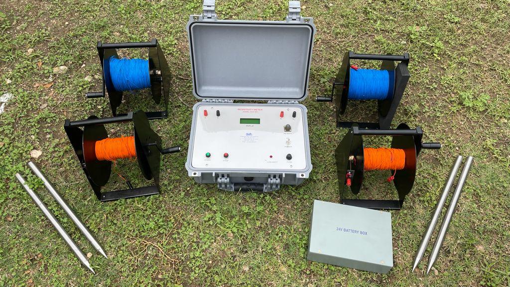
The real field investigations involved studying topographic expressions, linearments, fractures / faults, vegetation appearance, geology followed by detailed Hydrogeological and Geophysical surveys in the community selected areas. The strategy was to identify sites with multi-layered aquifer system using geophysical and hydro geological methods. The geophysical survey was done by means of resistivity measurements in the form of Profile and Vertical Electrical Surroundings using as ABEM SAS 300c Terrameter.
Profiling
The resistivity profiles were run with AB (current electrode separation) of 58 and 83m and a station interval of 10m, MN (Potential electrode separation) was fixed at 10m. The aim of survey with resistivity profiles is to map anomalous resistivity values. These may be caused by presence of a fractured zone and or deeper weather section that may be favorable for groundwater abstraction. Profiles were run across the lineament features previously identified from the aerial photograph interpretation. Precise location of the Resistivity Anomaly (PLRA) method was used to determine lineament direction and investigation further the best identified VES for sites on the profile.
Resistivity sounding
Vertical Electrical Soundings were subsequently carried out on the centres of the best anomalies identified on Geo-electrical line profiles. A maximum 1/2AB of 120m was used with a 1/2MN of 0.5 and 5m. The surroundings were carried out to get an insight on the differences in depth and type of the overburden. Interpretation of the sounding curves was carried out using a computer-modelling program know as RESIST. Modelling is based on a mathematical curve fitting procedure.
There is 40 times as much ground water below the earth surface as the in the World’s streams and lakes. However the groundwater is unequally distributed with none in some areas so we carryout a professional hydro-geological survey to ascertain suitable sites for exploration of significant quantities of groundwater before carrying out any drilling exercise. We use the resistivity method to assist in the assessment of geological sub surface conditions; through Vertical Electrical Sounding (V.E.S) and Horizontal Electrical Profiling (H.E.P). This limits of drilling dry boreholes.
Our hydro-geological surveys includes:
A preliminary desk study is always conducted using geological maps, topography maps, aerial photographs and review of existing data
Site reconnaissance and site field tests.
The hydro-geological data, maps graphs and cross-section profiles obtained from the hydro-geological survey. The company has two sets of ABEM Tarrameters SAS 1000 the PASI Resistivity meter.
We have highly qualified personnel equipped with the right methodology, tools, skills and field experience ensuring quality service for our clients. and existing borehole data. In case of production boreholes aero photographs are included in the preliminary work